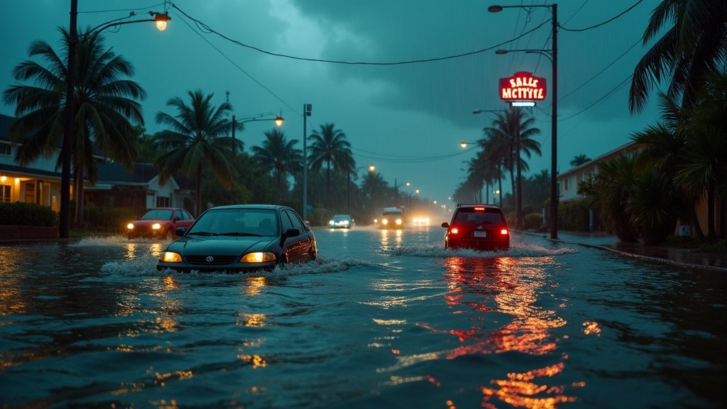
Miami, FL – Residents across Miami-Dade and Broward counties are contending with significant disruptions today, Tuesday, September 9, 2025, following an afternoon of torrential rainfall that has inundated streets, submerged vehicles, and created hazardous travel conditions. The relentless downpour, characterized by heavy thunderstorms, has overwhelmed drainage systems, leading to widespread flash flooding and prompting emergency responses. This developing news is making headlines as the region braces for continued unsettled weather.
Afternoon Deluge Triggers Widespread Flooding
The skies opened up across South Florida this afternoon, unleashing a deluge of rain that quickly overwhelmed urban infrastructure. Areas like Edgewater and the Flagami neighborhood in Miami-Dade experienced severe street flooding, with water levels rising rapidly. Reports indicate that some vehicles were submerged, turning familiar streets into temporary waterways. In Broward County, the storm brought its own dramatic elements, including a lightning strike that reportedly hit and damaged a street light in Pembroke Park. The intensity of the rainfall, coupled with existing poor drainage, created a significant public safety concern, impacting daily life for thousands of residents.
Commuters Face Significant Disruptions
The heavy rainfall has had a cascading effect on transportation throughout the affected counties. Driving conditions became treacherous, with many roads rendered impassable due to standing water. The Flagami neighborhood, in particular, saw several streets become waterlogged, significantly hindering commutes for drivers. Pedestrians also faced challenges navigating the flooded areas, with some forced to wade through rising waters. The National Weather Service had previously warned of a potential for flash flooding, with both Broward and most of Miami-Dade counties placed under a Level 1 risk by the Weather Prediction Center. This alert underscored the anticipated severity of the storms developing around midday and becoming more widespread through the afternoon and evening.
Infrastructure Under Strain and Emergency Response
City crews have been working overtime, deploying pumps in affected areas such as Miami’s Edgewater neighborhood to manage the rising water levels. The rapid accumulation of water highlights the strain on the region’s drainage systems, which are crucial for mitigating the impact of intense storm events. The combination of a stalled frontal boundary and an area of low pressure has kept the atmosphere moist and unstable, contributing to the persistent storms and heavy downpours. The Weather Prediction Center noted that this pattern would likely continue, contributing to a lingering flood threat through the week. This ongoing situation emphasizes the critical need for robust and well-maintained stormwater management infrastructure across South Florida.
Broader Weather Context and Lingering Threats
The heavy rainfall event is part of a larger pattern of unsettled weather expected to persist across South Florida through the week. Forecasters anticipate continued chances of rain and scattered storms each afternoon and evening, with the potential for localized flooding. While highs are expected to remain seasonably hot, near 90 degrees, with heat index values climbing into the upper 90s and low 100s, the rain offers temporary relief from the humidity. The National Weather Service had issued a Flash Flood Warning for parts of Miami-Dade on Monday afternoon, affecting areas including Miami International Airport, Hialeah, Coral Gables, Miami Springs, and Allapattah, which experienced dangerous road conditions and flight delays. Conditions are forecast to gradually improve over the weekend, with highs potentially easing into the upper 80s as an onshore breeze develops.
Resident Impact and Future Outlook
Residents like Andres Veléz in the Edgewater area found their vehicles submerged, facing significant water damage and the arduous task of assessing and repairing their property. His car was flooded, requiring a tow and an uncertain path to determining the extent of water damage. The incident serves as a stark reminder of the vulnerability of coastal communities to extreme weather events. Authorities continue to urge motorists to exercise caution and avoid driving through flooded intersections, reinforcing the “turn around, don’t drown” message. The region is no stranger to intense rainfall, but the cumulative effect of these storms underscores the importance of preparedness and resilient infrastructure in the face of a changing climate. As the storm system moves through, the focus remains on ensuring public safety and mitigating the damage caused by this significant weather event. The news of this widespread flooding is trending across local and national platforms.


