Tropical Storm Isaias is rapidly organizing in the waters off the coast of Mexico, setting the stage for what forecasters at the National Hurricane Center (NHC) are calling a significant weather event. As the storm gains momentum, the Miami-based agency is working around the clock to track its trajectory and coordinate monitoring efforts with regional emergency management authorities. Residents across the U.S. Gulf Coast are being advised to finalize their hurricane preparedness plans, as current meteorological models suggest the system will strengthen into a hurricane before making landfall later this week.
Key Highlights
- Storm Genesis: Tropical Storm Isaias has formed off the Mexican coast and is currently undergoing intensification.
- Hurricane Projection: Forecasters expect the system to reach hurricane status as it moves across warmer Gulf waters.
- Direct Threat: The U.S. Gulf Coast is the primary area of concern for potential landfall later this week.
- Active Coordination: The Miami-based National Hurricane Center (NHC) is providing continuous updates and managing tracking efforts.
Navigating the Impending Storm: Meteorological Shifts and Regional Preparedness
The formation of Tropical Storm Isaias marks a pivotal moment in the current Atlantic hurricane season. As the system pivots toward the U.S. Gulf Coast, the interplay between environmental conditions and the storm’s internal structure has become the focus of intense scrutiny by atmospheric scientists. Understanding the transition from a tropical storm to a hurricane requires a look at the thermodynamic variables currently at play in the Gulf.
The Science of Rapid Intensification
When a tropical system like Isaias moves over the Gulf of Mexico, it encounters warm surface waters—often referred to as ‘hurricane fuel.’ This heat energy, coupled with low vertical wind shear, allows the storm to organize its convective clouds into a tight, circular eyewall. Forecasters look for a drop in central pressure as a key indicator that the storm is shifting from a tropical storm, characterized by sustained winds of at least 39 mph, into a hurricane, defined by sustained winds of 74 mph or higher on the Saffir-Simpson Hurricane Wind Scale.
As Isaias moves closer to the coast, the NHC’s computer models are assessing the ‘track error’—the variance in where the storm might strike. Because the Gulf Coast is a low-lying, complex coastline featuring intricate barrier islands, wetlands, and major industrial hubs, even a minor shift in the storm’s track can result in significantly different outcomes for storm surge, wind damage, and precipitation amounts.
Monitoring and the Role of the National Hurricane Center
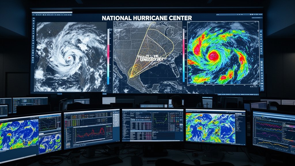
Headquartered in Miami, Florida, the National Hurricane Center serves as the nerve center for tropical cyclone observation. Their coordination efforts involve a global network of satellites, aircraft reconnaissance (the famed ‘Hurricane Hunters’), and coastal radar stations. For Isaias, this team is synthesizing data from the Global Forecast System (GFS) and the European Centre for Medium-Range Weather Forecasts (ECMWF) to provide the most accurate cone of uncertainty.
This ‘cone’ is not a prediction of the storm’s size, but rather a representation of where the center of the storm is most likely to move. Residents in the path must look beyond the center line of this cone, as hurricane-force winds and life-threatening storm surges often extend well away from the storm’s core. The NHC’s coordination with local officials ensures that evacuation orders, if necessary, are issued with sufficient lead time to clear population centers.
Economic and Infrastructural Implications
The U.S. Gulf Coast is home to critical national infrastructure, including major shipping lanes, refineries, and energy distribution hubs. A hurricane impact in this region often carries ripples that extend beyond local property damage. The potential for disruption to energy markets and logistics chains is a primary concern for policymakers. Businesses and industrial operators in the region have already begun executing their emergency continuity plans, which include the secure shutdown of sensitive equipment and the evacuation of non-essential personnel from offshore platforms and coastal facilities.
Historically, the Gulf Coast has shown remarkable resilience in the face of tropical cyclones, yet each event presents unique challenges. The focus for Isaias is on managing the potential for ‘rapid intensification’—a phenomenon where a storm increases its wind speed by at least 35 mph in a 24-hour period. This creates a challenging scenario for local emergency managers who must balance the urgency of evacuation against the need to minimize unnecessary traffic and social disruption.
Preparing for the Impact
Preparedness is the bedrock of hurricane survival. Experts at the National Hurricane Center emphasize three key pillars for residents in the projected path: knowing your evacuation zone, having a ‘go-bag’ with essential documents and supplies, and staying informed through official, verified news sources. As Isaias progresses, the window for effective preparation is shrinking. Residents should monitor local weather alerts, secure outdoor furniture, and ensure their emergency kits are stocked with water, non-perishable food, and medical supplies. By taking proactive measures now, communities can significantly reduce the risk of harm as the storm makes its approach.
FAQ: People Also Ask
Q: What is the primary difference between a tropical storm and a hurricane?
A: A tropical storm has sustained winds between 39 and 73 mph. Once the sustained wind speed reaches 74 mph or higher, it is classified as a hurricane.
Q: Where can I find the most accurate tracking information for Isaias?
A: The National Hurricane Center (nhc.noaa.gov) is the official source for all tropical cyclone tracks, watches, and warnings. Avoid social media rumors.
Q: How does the Gulf Coast topography affect storm impact?
A: The shallow, sloping continental shelf of the Gulf Coast allows storm surge—the rise in seawater level—to push further inland, often causing more flooding than the wind itself.
Q: When should I evacuate if an order is issued?
A: You should evacuate immediately upon the instruction of local officials. Delaying evacuation not only puts your life at risk but can also strain emergency resources.